Greetings from Victoria Australia and welcome to this blog covering the summer weather! As well as analysis, expect to see first-hand pics and video. But first a bit of background to set the scene.
With a building La Nina, things are finally starting to crank – as at 30 December 2020. Tropical moisture is building over Northern Oz and is about to be advected down the eastern side of the continent. From 31st December, storms are forecast to develop over mainly northern / north eastern parts of Victoria before extending southward through New Years Day and into the following week.
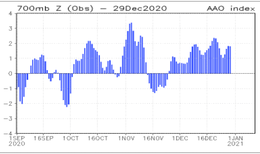
SAM is currently positive indicating that high pressure ridges will be south of the continent thus allowing the Monsoon Trough to move south toward northern Oz (bringing tropical moisture with it).
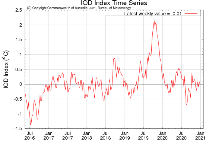
IOD (Indian Ocean Dipole) is currently at close to zero at the moment (so plenty of moisture will be sucked into the atmosphere off the NW Shelf).
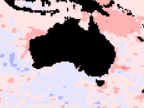
Sea surface temperature anomalies indicate warmer waters off the northwest shelf, the Coral Sea and parts of the Tasman Sea.

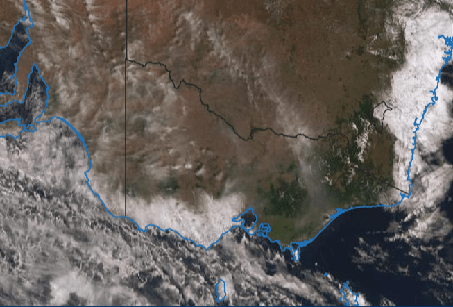
The water vapour satpic at 00Z 30/12/20 shows mid to high level moisture already appearing over Victoria. Which can be seen as Cirrus / Cirro Stratus in the visual satpic below:
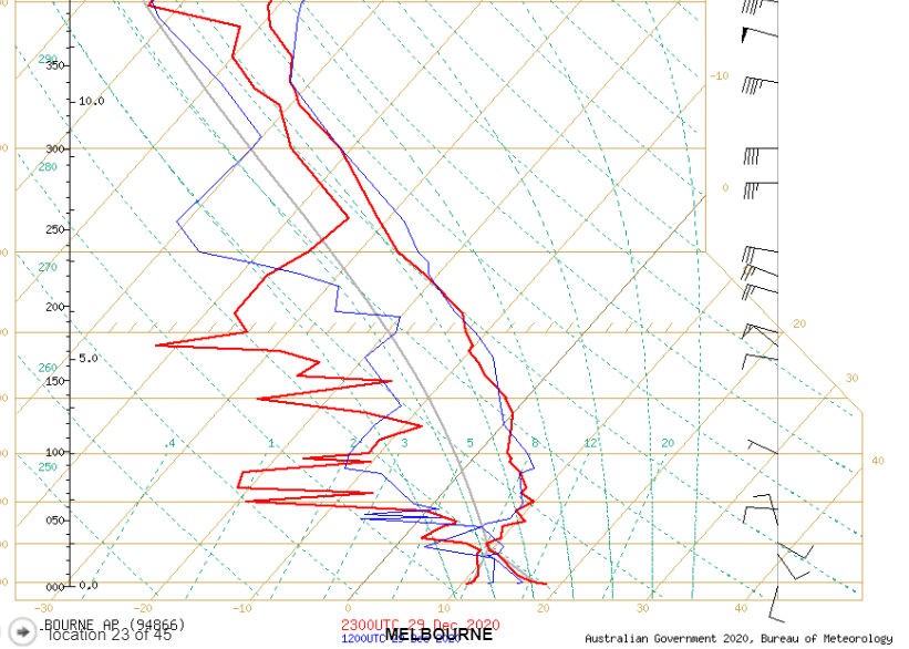
The latest sounding chart 2300Z (Skew-T) for Melbourne (courtesy BoM) also shows the moisture in the mid to high levels. (Note the 2 red lines coming close together between 26000 & 38000 ft). Obviously no storms today, but indicative of the build up.

In the above pic showing surface winds, a convergence line can be clearly seen along the eastern ranges, as well as the surface trough running north – south through New South Wales (expected to extend south into Vic in the next 24hrs).
Morning folks. From looking at all the Aviation stuff put out by the BoM, the NE of Vic looks the best area for anything to fire storm wise today 31/12/2020. Steering is minimal so any storms will hardly move and so will be easy to catch – unless over the mountains. Will just have to wait and see what develops and where. As at 0730 Melbourne time, Pretty Sally (where the BoMs Kilmore Gap AWS is) is shrouded in fog!
Latest Severe Weather briefing from Emergency Management Vic:
Significant weather commentary
• Thursday: Shower and thunderstorm activity focused over NE Victoria this afternoon – heavy rain a risk.
– Thunderstorm activity contracting to northern border tonight although isolated storms could develop over the south/west just after midnight.
• Friday: Thunderstorms likely across all of the State apart from the Gippsland coast.
– Heavy rain the main risk – storms likely to be slow moving – totals of 20-30mm possible. Large hail/damaging wind also possible. Activity easing at night.
• Saturday: Thunderstorms likely across all districts again, but particular focus over the west and Dividing Range.
– Heavy rain again greatest concern with storms likely to be slow moving – 30-40mm possible, large hail/damaging winds also a risk.
• Sunday: Thunderstorms again possible across all districts but faster moving – high moisture levels so small risk of heavy rain and large hail. Damaging winds a risk.
• Monday: Storm risk becomes confined to far northeast – heaviest rain associated with thunderstorms likely through the North East district.
Happy New Year to all! After a disappointing chase to Benalla yesterday (bang on for target area but storms fired over inaccessible and dangerous terrain), today looks to have better potential for Vic in general. Here are a few early morning shots from Kilmore Gap:


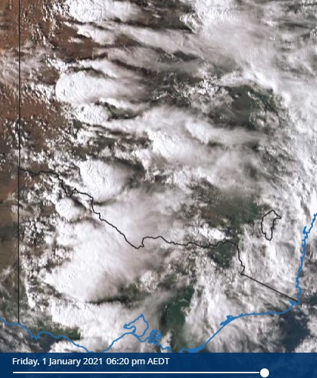
Unfortunately no storms in central Vic today, but tomorrow is another storm day (fingers crossed). Here is the latest (impressive) satpic clearly showing the current position of the trough line:
Today Saturday 2nd Jan, things were late to get going in Central / North Central Vic.

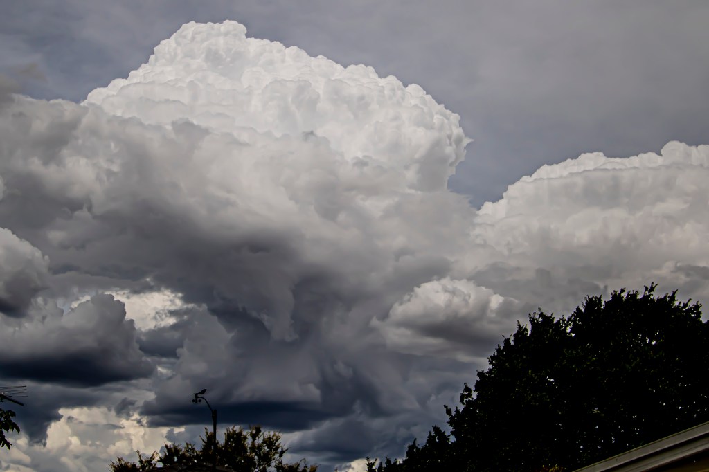
As it eventuated it was a bit of a bust for North Central Vic. Yesterday 15th January 2021, a short sharp front blasted through in the late afternoon. The skyscapes from Melbourne were spectacular to put it mildly! Here are a few pics:)